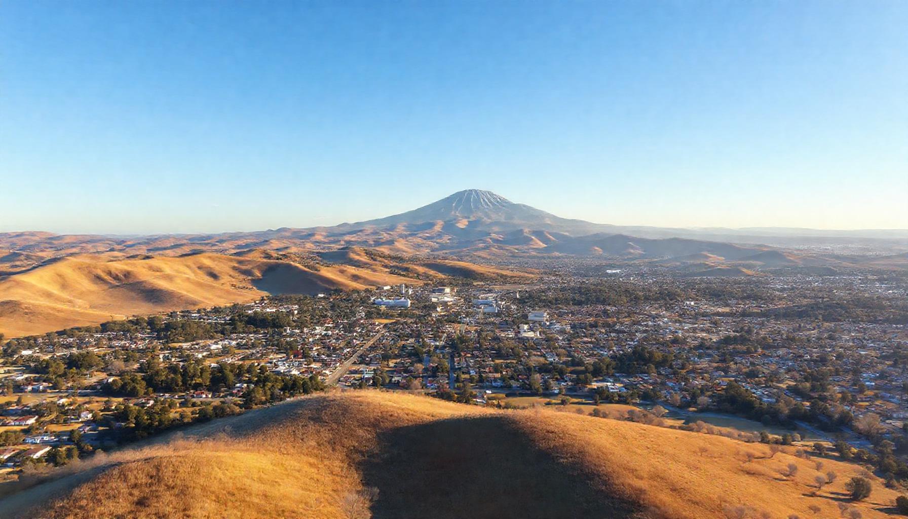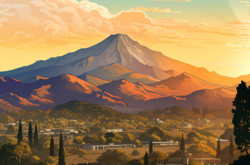
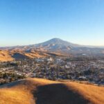


At 3,849 feet, Mount Diablo isn’t the tallest peak in the Bay Area—but it might offer the most spectacular payoff-per-foot of any summit in Northern California. On a clear day, the view from the top stretches nearly 200 miles in every direction: the Golden Gate Bridge and Farallon Islands to the west, the Sierra Nevada crest to the east, Lassen Peak to the north, and Mount Loma Prieta to the south. Parts of 40 of California’s 58 counties are visible from the summit. For Walnut Creek residents, the mountain is practically in the backyard—a 15-minute drive to the trailhead and a lifetime of trails to explore.
Mount Diablo State Park encompasses over 20,000 acres with more than 60 trails spanning everything from flat meadow walks to steep, exposed scrambles. Whether you’re a family with young kids, a weekend warrior looking for a quad-burning climb, or a seasoned trail runner hunting the park’s famous grand loop, here’s your comprehensive guide.
Getting Oriented: Gates, Trailheads, and When to Go
The park has two main vehicle entry points: South Gate Road (off Diablo Road in Danville) and North Gate Road (off North Gate Road in Walnut Creek). The South Gate entrance is closer to the summit; North Gate is the local’s choice with a more gradual, scenic approach. Both gates open at 8am and close at sunset. Day-use parking is $10 per vehicle.
Several trailheads sit outside the fee gates:
- Mitchell Canyon (off Mitchell Canyon Road in Clayton): Premier access for wildflower hikes and birding. Parking is $6. Arrive early—the lot fills by 8:30am during wildflower season.
- Macedo Ranch (off Green Valley Road): A quieter trailhead feeding into the lower-elevation trail network, with fewer crowds.
- Mangini Ranch Educational Preserve: Managed by Save Mount Diablo, this preserve offers guided hikes ideal for families and first-timers.
The best hiking season is October through May, when temperatures are moderate and the hills are green. Summer hiking (June–September) is doable but requires an early start: plan to be off exposed trails by 11am, as temperatures on the mountain can run 15–20 degrees hotter than in Walnut Creek. The mountain has very limited shade on most trails, and water sources are unreliable (and should not be relied upon). Carry at least one liter per person per two hours of hiking, and more in summer.

Water: One liter per person per two hours minimum. There are no reliable water sources on the mountain—do not plan on filtering or refilling.
Heat: Summer temperatures on exposed trails can exceed 100°F. Start by 7am or earlier from June through September. Know the symptoms of heat exhaustion: headache, dizziness, nausea, clammy skin.
Wildlife: Rattlesnakes are active in warm months. Stay on trails, watch where you step, and listen for the warning rattle. Mountain lions are present but rarely seen; if you encounter one, make yourself large, make noise, and do not run.
Navigation: Cell service is spotty. Download offline maps before you go or carry a paper map (available at the Summit Visitor Center and park entrances).
Seasonal Closure: Castle Rock and Knobcone Point are closed to public access February 1 through July 31 for peregrine falcon nesting. Respect closures—violations carry fines.
The Best Trails by Skill Level
Beginner & Family-Friendly
Rock City Area: Not a single trail but a network of short paths winding through massive sandstone formations just inside South Gate. Kids love the wind caves and rock scrambling. The trails are flat, shaded in spots, and you can turn around at any point. Perfect for a 2–3 hour outing with a picnic. The sandstone formations, carved by wind and water over millions of years, are fascinating even for adults—bring a camera.
Mary Bowerman Trail: A 0.7-mile interpretive loop near the summit that circles the peak just below the visitor center. It’s paved, mostly flat, and features interpretive signs about the mountain’s geology, ecology, and history. The views along this trail are nearly as impressive as from the summit itself—it’s arguably the best effort-to-reward ratio in the entire park. Accessible to most mobility levels.
Intermediate
Mitchell Canyon to Deer Flat: Starting from the Mitchell Canyon trailhead, this 6-mile round trip climbs roughly 1,600 feet through one of the park’s most beautiful canyons. Spring wildflowers here are spectacular—poppies, lupines, and dozens of endemic species that exist only on Mount Diablo. The trail follows a gentle creek bed for the first mile before climbing more steeply to Deer Flat. Birders should bring binoculars; the canyon is known for acorn woodpeckers, western bluebirds, and the occasional golden eagle.
Juniper Trail to Summit: Starting from the lower summit parking lot, this 3-mile out-and-back climbs roughly 800 feet to the summit via a mix of switchbacks and ridge walking. The juniper-and-chaparral landscape is classic Diablo, and the final approach to the summit tower is dramatic. This is the go-to hike for visitors who want to summit without committing to the full climb from the base.
Advanced
Grand Loop Trail: The park’s signature challenge, the Grand Loop links multiple trails into a roughly 7-mile circuit with over 2,000 feet of elevation gain. The standard route starts at Juniper Campground, follows Deer Flat Road to Meridian Ridge, connects to Prospectors Gap, and returns via the North Peak Trail. It’s a full-day commitment that requires solid fitness, reliable navigation (trail junctions can be confusing), and at least three liters of water per person. The reward: you’ll see parts of the mountain that most visitors never reach.
Four Peaks Loop: For the truly ambitious, this route tags Mount Diablo, North Peak, Mount Olympia, and Eagle Peak in a single day. It’s roughly 15 miles with 4,000+ feet of elevation gain and loss. Not for beginners. Save Mount Diablo’s annual Four Days Diablo event is a great way to experience it with support.
The Summit Experience
You can drive to the summit, and plenty of people do—but there’s something about earning the view on foot that makes the observation deck hit differently. The historic Summit Visitor Center, housed in a 1930s stone building constructed from fossiliferous sandstone quarried on-site, is open daily from 10am to 4pm. Inside you’ll find exhibits on the mountain’s geology and cultural history, a gift shop, and a diorama of the park’s ecosystems. (Note: the elevator is currently out of service, so the observation deck at the top of the tower is accessible only by stairs.)
From the observation deck, you can see 8,539 square miles of California. The view takes in the Golden Gate, the Farallon Islands, the Santa Cruz Mountains, the Sierra Nevada, and even Mount Lassen on the clearest days. The best viewing conditions typically come the day after a winter storm, when rain-scrubbed air delivers maximum clarity. Summer views are often hazier but still spectacular, especially at sunrise and sunset.
| Trail | Distance | Elevation Gain | Difficulty | Best Season |
|---|---|---|---|---|
| Rock City Area | 1–3 miles (variable) | Minimal | Easy | Year-round |
| Mary Bowerman Trail | 0.7 miles (loop) | ~50 ft | Easy | Year-round |
| Mitchell Canyon to Deer Flat | 6 miles (out and back) | ~1,600 ft | Moderate | Spring (wildflowers) |
| Juniper Trail to Summit | 3 miles (out and back) | ~800 ft | Moderate | Fall through Spring |
| Grand Loop Trail | ~7 miles (loop) | ~2,000 ft | Strenuous | Oct–May |
| Four Peaks Loop | ~15 miles (loop) | ~4,000+ ft | Very Strenuous | Oct–May (full day) |
Trail Etiquette and Rules to Know
Mount Diablo is heavily used by hikers, cyclists, and equestrians sharing the same trails and roads. Knowing the right-of-way rules keeps everyone safe:
- Horses have priority. Cyclists and hikers yield to equestrians. If you see a horse, step to the downhill side of the trail, speak calmly so the horse knows you’re human, and let them pass.
- Hikers yield to horses, cyclists yield to both. On multi-use trails, mountain bikers should yield to hikers and horses, though in practice hikers often step aside to let bikes pass.
- Stay on designated trails. Cutting switchbacks causes erosion that takes years to repair. The park’s fragile chaparral and grassland ecosystems recover slowly.
- Drones are prohibited. Mount Diablo State Park has a standing order banning all unmanned aircraft systems, including drones.
- Leave no trace. Pack out everything you pack in. Collecting or disturbing anything in the park—including mushrooms, wildflowers, and rocks—is prohibited.
The mountain is open every day of the year except for rare closures during extreme fire weather. For current conditions, check the Mount Diablo State Park page on the California State Parks website or call the park office before heading out. For guided hikes that dive deeper into the mountain’s ecology, history, and conservation, Save Mount Diablo runs year-round programs that are worth every minute.