

CONTRA COSTA COUNTY, CA — There is a version of the East Bay where the trails are wider, the parking lots are bigger, and the open spaces you thought were protected are not. There is another version where conservation wins over development, where neighborhoods that have been historically shortchanged on park access finally get equity in the district’s plans, and where the next generation of East Bay residents inherits a park system that looks more like the region it serves.
Which version materializes depends, in no small part, on whether people show up to a community fair in Concord on Saturday morning.
The East Bay Regional Park District is developing its next District Plan — a long-range planning document that will guide decisions on parkland acquisition, trail development, habitat conservation, recreation programming, and community services for years to come. As part of that process, the district is holding a series of public outreach events across Alameda and Contra Costa counties, including one this Saturday at the Concord Senior Center from 10 a.m. to noon.
What Is Actually at Stake
The East Bay Regional Park District is not a minor agency. It manages 73 parks across two counties, encompassing more than 125,000 acres of open space, 1,300 miles of trails, and 55 miles of shoreline. For context, that is roughly ten times the acreage of the entire city of Walnut Creek, spread across a district that stretches from Richmond to Livermore.
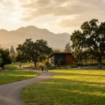
For Walnut Creek residents specifically, the district oversees the places that define outdoor life in the region: the Diablo Foothills, Shell Ridge Open Space, the Iron Horse Regional Trail, and the connected trail systems that allow people to bike from downtown to the base of Mount Diablo without touching a road.
The District Plan is where decisions get made about what gets protected, what gets developed, and what gets prioritized. It shapes where new trails are built, which habitats get conservation funding, whether recreation programs expand or contract, and how the district responds to climate pressures like wildfire risk and drought. These are not abstract planning questions. They are the answers that determine whether your local trailhead has parking or a portable toilet, whether the ridge behind your neighborhood stays open space or gets eyed for development, and whether the next generation of East Bay kids has access to the same outdoor experiences.
A Party Disguised as a Planning Meeting
The Saturday event is being held in partnership with the City of Concord as part of the Concord Senior Center’s Parks and Community Resource Fair. It will feature food, live music, and activities for all ages. Park District staff and local community organizations will be on hand to discuss programs, recreation opportunities, and career paths within the district.
The outreach strategy is intentional. Standard public planning meetings tend to draw the same demographic: older, whiter, more affluent, and already deeply engaged with local government. By embedding the outreach inside a community fair with food and music, the district is trying to reach people who would never attend a podium-style public hearing — younger families, working people, residents from communities that have been historically underrepresented in land-use decisions.
Whether the strategy works depends on who shows up. The residents who attend will shape the plan. The residents who stay home will have the plan shaped for them.
A District Born From a Fight
The East Bay Regional Park District exists because of a moment very much like this one. In 1934, as the East Bay was urbanizing rapidly, a group of citizens looked at the hills above Oakland and Berkeley and saw something worth protecting before it was too late. They organized. They gathered 8,000 signatures. They put a measure on the ballot to create the park district and fund it with a nickel-per-$100 property tax. It passed by 71 percent.
Ninety-two years later, the district is the largest regional park system of its kind in the United States. But the pressures it was created to address — development encroachment, loss of open space, inequitable access to nature — have not gone away. If anything, they have intensified. The Bay Area is projected to add more than two million residents by 2050. Every new housing development, every expanded road, every shift in land use puts pressure on the region’s remaining open space.
For Contra Costa County specifically, the stakes are acute. The county sits at the boundary between dense urban development and some of the most ecologically significant landscapes in Northern California. The decisions made in this District Plan cycle will shape whether that boundary holds or erodes.
The Iron Horse Trail and What It Represents
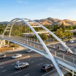
If you want to understand what the Park District actually does for Walnut Creek, start with the Iron Horse Regional Trail. The trail runs for 32 miles from Concord to Pleasanton, tracing the path of the old Southern Pacific Railroad line. It cuts straight through downtown Walnut Creek, past the BART station, past the library, past neighborhoods where kids bike to school on it and commuters use it to get to work without touching a car.
Maintaining a 32-mile trail corridor across multiple cities requires coordination with a dozen different jurisdictions, ongoing maintenance funding, and a planning framework that accounts for future development pressure along the corridor. None of that happens by accident. It happens because the Park District has a plan, and the plan has teeth.
The same is true for Shell Ridge, for the Diablo Foothills trails, for the open space that separates Walnut Creek from the sprawl creeping east from the I-680 corridor. These places exist in their current form because past District Plans protected them. Future plans will either extend that protection or weaken it. The community fair on Saturday is the moment when that future starts getting written.
The Two-Hour Window
Public planning processes are not designed to be convenient. They are designed to satisfy legal requirements for community input. The result is that most people never participate, and the input that shapes the plan comes disproportionately from the people who have the time and resources to engage: retirees, homeowners, longtime residents who already know how the system works.
The Park District’s decision to embed its outreach inside a community fair is a recognition of that dynamic. It is an attempt to reach people who would never sit through a three-hour planning commission meeting but might spend fifteen minutes talking to a staff member while their kids eat free food and listen to live music.
Whether the attempt succeeds depends, as these things always do, on turnout. The plan will get written either way. The only question is whose voices are in it.
How to Participate
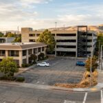
The event runs Saturday from 10 a.m. to noon at the Concord Senior Center, 2727 Parkside Circle in Concord. It is free and open to all. For those who cannot attend in person, the Park District has an online survey available through its website where residents can submit feedback on park priorities, trail access, recreation programming, and conservation goals.
The District Plan will be in effect for years. The community fair lasts two hours. The math on that ratio is worth considering.