


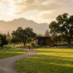





WALNUT CREEK, CA — This town sets aside more open space per capita than almost any city in California. Two of its best hiking spots are also its least known.
Residents know the Iron Horse Trail. They know Mount Diablo looming to the east. What gets overlooked are Lime Ridge and Shell Ridge — nearly 2,000 acres of protected ridgeline.
The 1974 Open Space Bond: A Defining Moment
In 1974, Walnut Creek voters approved a $6.7 million bond to buy open space. Few California cities had tried that before.
The vote protected more than 1,800 acres of ridgelines, canyons, and oak woodland. It still shapes the city’s edges today.
The bond’s legacy lives on through partners like the East Bay Regional Park District, Save Mount Diablo, and the John Muir Land Trust.
Together they have protected thousands of acres, linking Walnut Creek to the wider East Bay conservation network.
Lime Ridge Open Space
Lime Ridge is the northern sentinel of the system. It is roughly 1,200 acres of grassland and oak woodland.
The ridge rises between Ygnacio Valley Road and the Concord border. Its name comes from limestone deposits that color the cliffs pale gray.
The trail network mixes wide fire roads with narrow single-track. Most routes are moderate.
The ridge runs north to south. On clear days the views sweep from Mount Diablo to the Carquinez Strait.
In spring the slopes burn orange and purple with poppies and lupines. It is the closest thing to a wildflower show this side of the foothills.
Lime Ridge connects directly to the Diablo Foothills Regional Park, part of the East Bay Regional Park District. This connectivity is no accident — conservation advocates worked for decades to stitch together a contiguous wildlife corridor from Walnut Creek into the Diablo foothills. Today, deer, coyotes, bobcats, and golden eagles move freely across lands that were once threatened by subdivision proposals.

Shell Ridge Open Space
Shell Ridge covers about 800 acres on the southern edge of town. It stretches east from Borges Ranch toward the Diablo foothills.
The name nods to the marine fossils in its rock, remnants of an ancient seabed.
Where Lime Ridge is broad and open, Shell Ridge feels intimate. Trails wind through dense oak groves and past seasonal creeks.
The network links to Acalanes Ridge and Indian Valley. Together they form a trail system that spans several cities.
Expect fewer people out here than at Lime Ridge. That quiet is most of the appeal.
Lime Ridge vs. Shell Ridge: At a Glance
| Feature | Lime Ridge | Shell Ridge |
|---|---|---|
| Acreage | ~1,200 acres | ~800 acres |
| Difficulty | Easy to moderate | Moderate |
| Best For | Families, panoramic views, wildflowers | Solitude, oak groves, geology |
| Landscape | Open grassland, limestone outcroppings | Oak woodland, sedimentary ridges |
| Connects to | Diablo Foothills Regional Park | Acalanes Ridge, Indian Valley |
| Wildlife | Golden eagles, deer, bobcats | Coyotes, hawks, wild turkeys |
| Peak Season | Spring (March–May) | Year-round |
Wildlife, Geology, and What You’ll See
Both open spaces teem with wildlife. Oak woodlands draw acorn woodpeckers, western bluebirds, and red-tailed hawks.
Grasslands host California ground squirrels and western fence lizards. In winter, watch for northern harriers hunting low over the fields.
Mule deer and coyotes are common at dawn and dusk. Bobcats live here too, but you will rarely spot one.
Come at first light for the best odds. The trails smell of bay laurel and dry grass most of the year.
Shell Ridge rewards anyone who likes rocks. Its sedimentary layers hold marine fossils from the Miocene epoch.
That was roughly 10 to 15 million years ago, when much of the Central Valley was an inland sea. Lime Ridge’s limestone tells a similar story.
The East Bay Conservation Network
Walnut Creek’s open spaces do not exist in isolation. They are part of a larger story that spans the East Bay.
East Bay Regional Park District manages Diablo Foothills Regional Park, which connects straight to Lime Ridge. It is the largest regional park district in the country.
Save Mount Diablo has protected land around the mountain since 1971. It works to build a wildlife corridor from the Diablo range to Suisun Bay.
John Muir Land Trust protects 23 properties and more than 4,600 acres across Contra Costa and Alameda counties.
Seasonal Tips for Visiting
Spring (March–May): the prime season. Wildflowers blanket Lime Ridge’s grasslands, peaking in April.
Trails are in great shape after winter rains. Go early on weekends, because parking fills fast.
Summer (June–September): the hills turn golden, but mornings stay pleasant.
Bring water. Neither open space has any. Rattlesnakes are active, so stay on trails and keep dogs leashed.
Fall (October–November): cooler air returns, and the light turns golden.
Oak trees drop acorns, drawing woodpeckers and deer. It is an underrated season for photos.
Winter (December–February): trails get muddy, but the hills turn green overnight.
The crowds thin out. After a storm, you can spot Mount Diablo and even Sierra snow from the ridgelines.
Getting There
Lime Ridge: the main trailhead sits at the end of Ygnacio Valley Road, near the Contra Costa Canal Trail.
You can also start off Treat Boulevard or Cowell Road. Parking is limited to small pullouts, so arrive early on weekends.
Shell Ridge: access through Borges Ranch at 1035 Castle Rock Road, where there is a small lot.
Sutherland Drive and Marshall Drive offer other entry points. Borges Ranch itself is a working ranch dating to 1899, worth a look on its own.
A Legacy Worth Exploring
The 1974 bond was a bet on the future. It wagered that residents 50 years on would value open space over subdivisions.
That bet paid off. Lime Ridge and Shell Ridge are monuments to a town that chose preservation when the outcome was far from certain.
Next time you want a trail without driving to Mount Diablo or the Berkeley Hills, head for Lime Ridge or Shell Ridge. The views are closer than you think.
I’ve already traced the town’s 175-year history and mapped the best trails on Mount Diablo. Know something I should cover? Reply or DM.